Finding Tiny Earthquakes by Their Fingerprints
A three-station seismic matched-filter experiment shows how repeating waveform shapes reveal small earthqua...

Magnitude 2.5+ over the past 24 hours.
Loading recent earthquakes…
A three-station seismic matched-filter experiment shows how repeating waveform shapes reveal small earthqua...

A simple shop-and-courier analogy explains how TCP delivers data, TLS protects it, and HTTP gives a website...
Recent technical articles on seismic analytics, scientific computing, numerical modeling, and production data workflows.
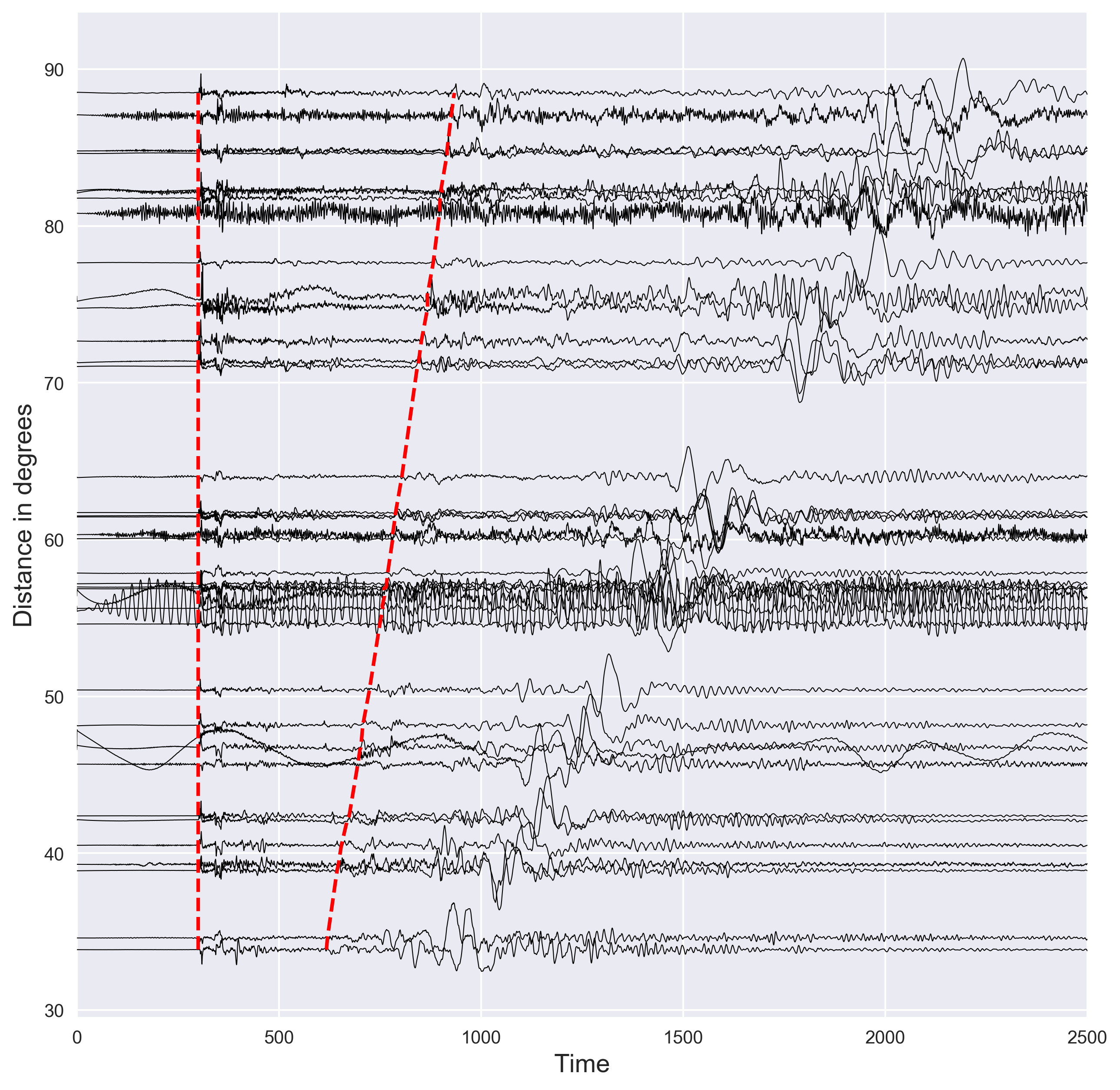
Short demostration of how to plot the distance vs seismic waveforms and mark the P and S arrival times using the IASP91 earth model. Codes are included.
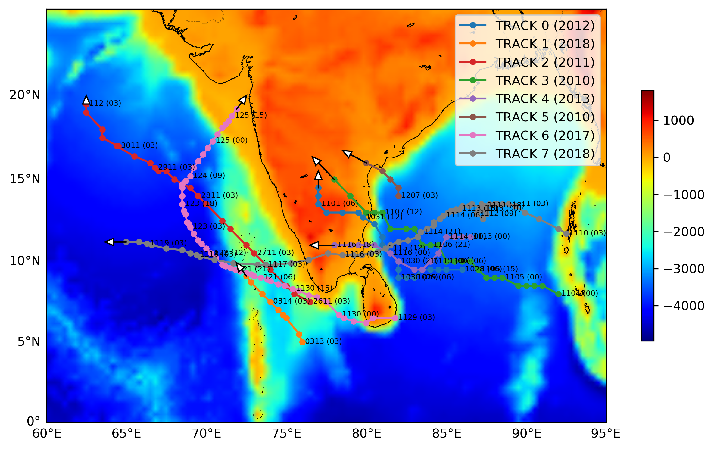
Short demonstration of how to plot the track or trajectory of a hurricane on a map. Codes are included.
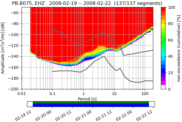
Short demonstration of the ppsd class defined in Obspy using 3 days of data for station PB-B075
Some handy tweaks for mac like relocating default screenshot location, renaming batch files etc
Mac can be easily automated by the help of several tools such as automator, quick actions, applescripts
Shortcut code for quickly logging temperature in Apple health app
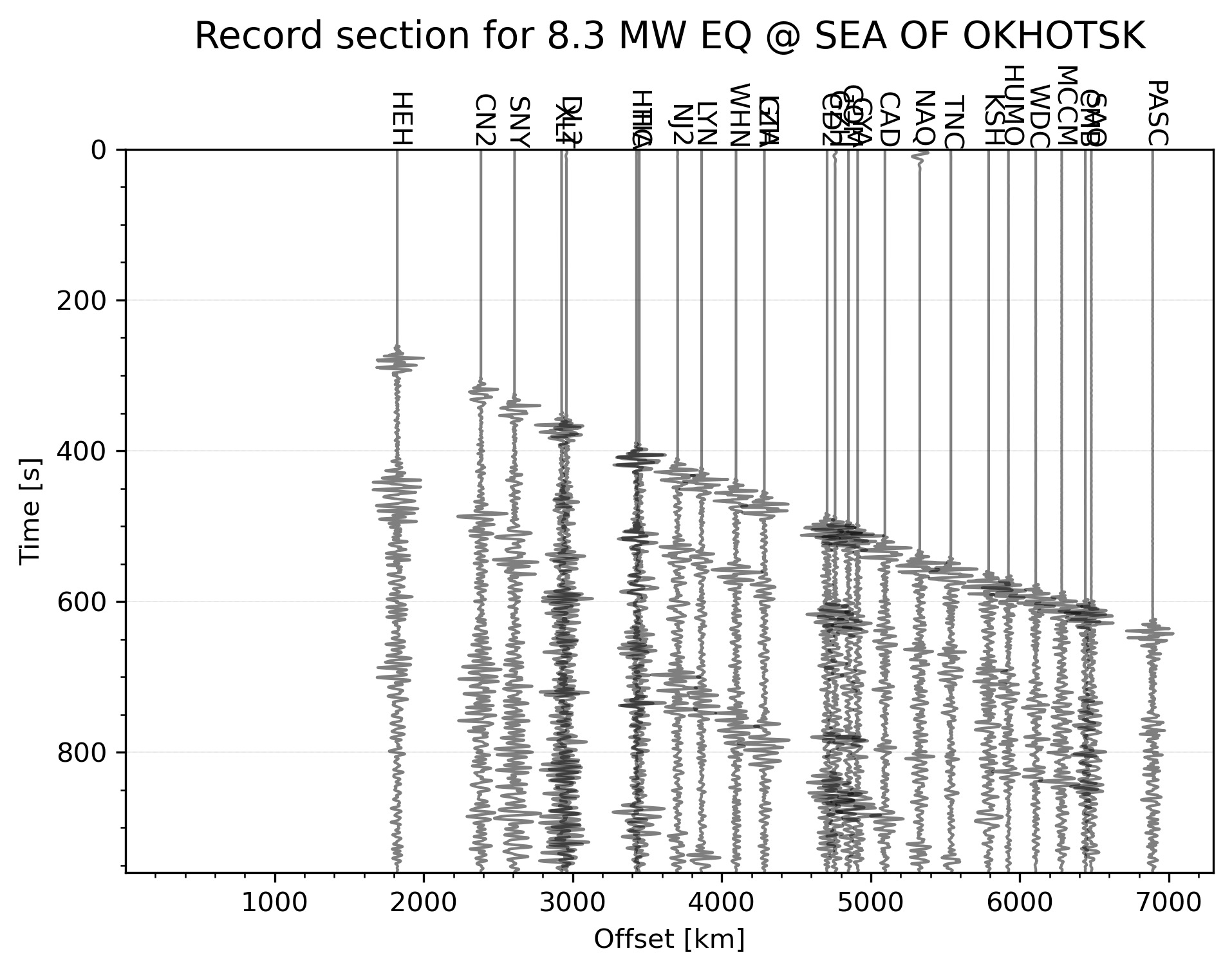
Python code to automatically plot the record section for the highest magnitude earthquake in the given time range
Quick action for mac to easily love, dislike, rate songs in apple music app
Introduction to the concepts of tomography with equations and codes. Introduction to the concepts of overdetermined, underdetermined and mix-determined probl...
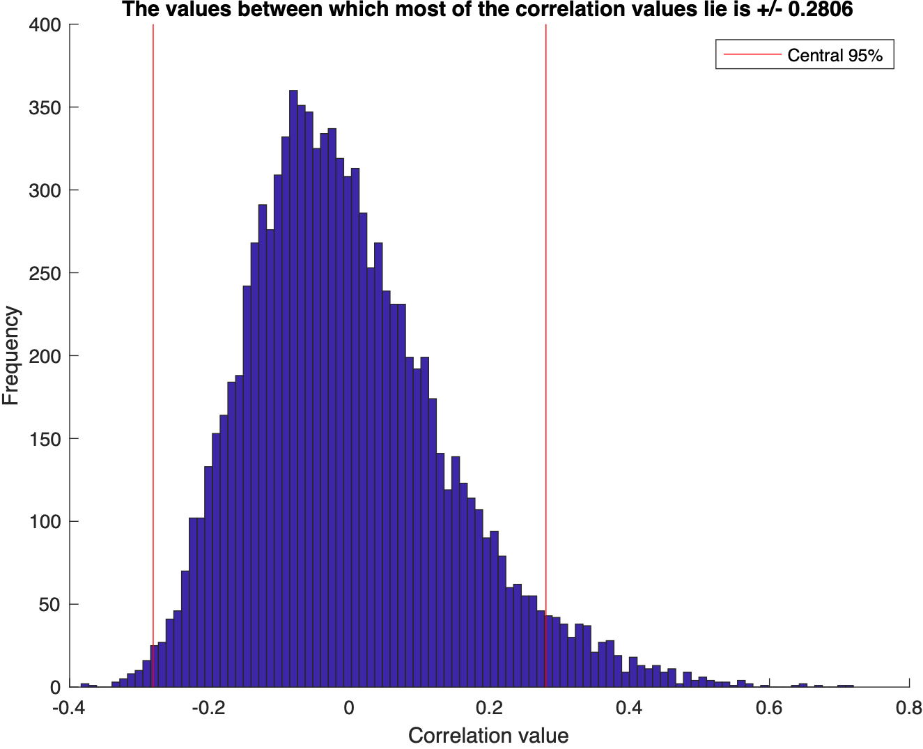
We test for the correlation coefficients or the covariance between two sets of random numbers selected from normal distribution using the Monte Carlo simulat...
Visualize the statistics of the data using MATLAB: mean, median, std, interquartile range, skewness, kurtosis, t-statistic, degrees of freedom
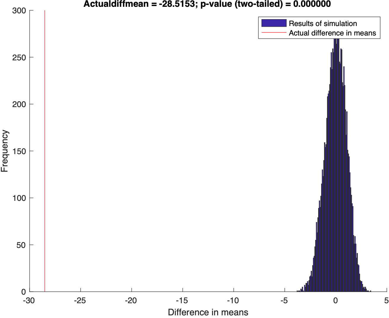
Using Randomization to test the disprove the null hypothesis
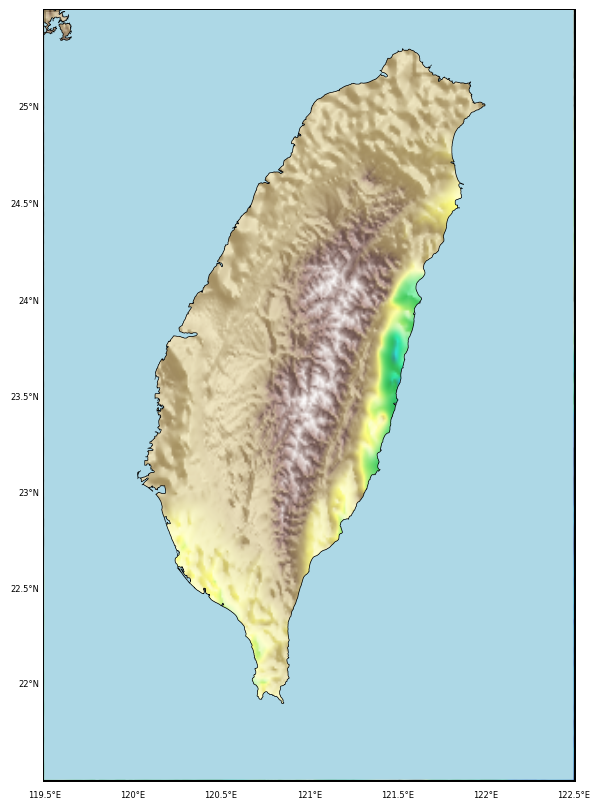
This post demonstrate how to use Python to set up clip topographic map based on coastlines.
Generating GMT style shaded relief map in Python
Short demostration of how to plot the distance vs seismic waveforms and mark the P and S arrival times using the IASP91 earth model. Codes are included.
Short demonstration of how to plot the track or trajectory of a hurricane on a map. Codes are included.
Short demonstration of the ppsd class defined in Obspy using 3 days of data for station PB-B075
Some handy tweaks for mac like relocating default screenshot location, renaming batch files etc
Mac can be easily automated by the help of several tools such as automator, quick actions, applescripts
Shortcut code for quickly logging temperature in Apple health app
Python code to automatically plot the record section for the highest magnitude earthquake in the given time range
Quick action for mac to easily love, dislike, rate songs in apple music app
Introduction to the concepts of tomography with equations and codes. Introduction to the concepts of overdetermined, underdetermined and mix-determined probl...
We test for the correlation coefficients or the covariance between two sets of random numbers selected from normal distribution using the Monte Carlo simulat...
Visualize the statistics of the data using MATLAB: mean, median, std, interquartile range, skewness, kurtosis, t-statistic, degrees of freedom
Using Randomization to test the disprove the null hypothesis
This post demonstrate how to use Python to set up clip topographic map based on coastlines.
Generating GMT style shaded relief map in Python
![Some handy mac tweaks [macos]](https://earthinversion.s3.us-west-1.amazonaws.com/mac-tweaks/open-in-terminal.jpg)
![Introduction to automating mac [macos]](https://earthinversion.s3.us-west-1.amazonaws.com/mac-automation/automator.jpg)
![Iphone shortcut to quickly log body temperature [ios]](https://earthinversion.s3.us-west-1.amazonaws.com/iosShortcuts/Fig2.jpg)
![Mac quick action to rate the songs in apple music app [macos]](https://earthinversion.s3.us-west-1.amazonaws.com/mac-quick-action/figure0.jpeg)
![Numerical tests on travel time tomography [matlab]](https://earthinversion.s3.us-west-1.amazonaws.com/tomographyModel1.jpg)