Turning Your Home Computer into a Home Server You Can Access Remotely

Turn your everyday computer into a home server you can access from anywhere. Learn how Dynamic DNS and a simple setup make remote connections secure and reliable.
Turn your everyday computer into a home server you can access from anywhere. Learn how Dynamic DNS and a simple setup make remote connections secure and reliable.
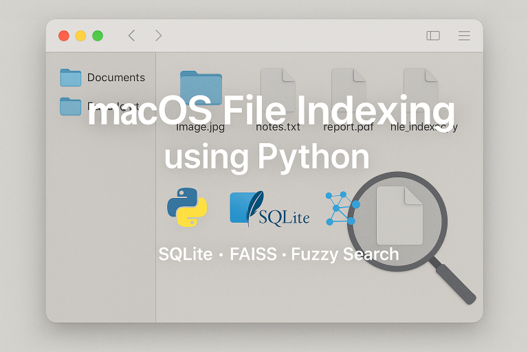
A Python-based solution for indexing and searching files on a macOS system
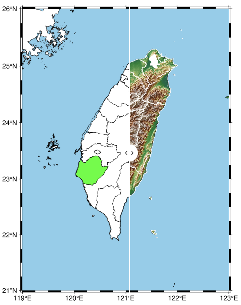
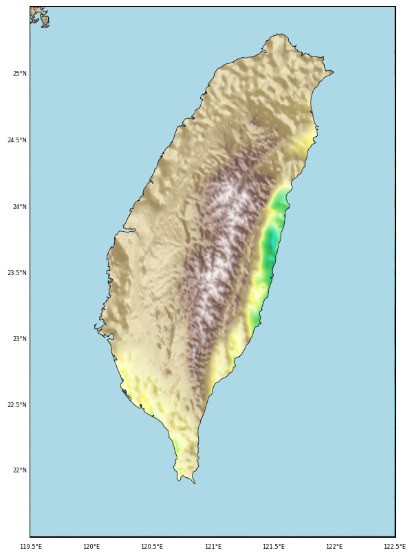
The PyGMT library in Python simplifies the creation of high-resolution topographic maps by providing built-in shorelines, country borders, and topographic data. By integrating geopandas, PyGMT enables users to overlay custom shapefile data, making it easy to highlight specific regions on a map. In this post, we demonstrate how to use county boundary data from Taiwan’s government portal to overlay on a high-resolution map of Taiwan, focusing on selected counties. This method provides a flexible, powerful approach for creating visually striking maps with customized geospatial information, applicable to various regions and datasets.

Python script to read a PDF document, and perform question-answering on the document, and to generate an output based on the provided query
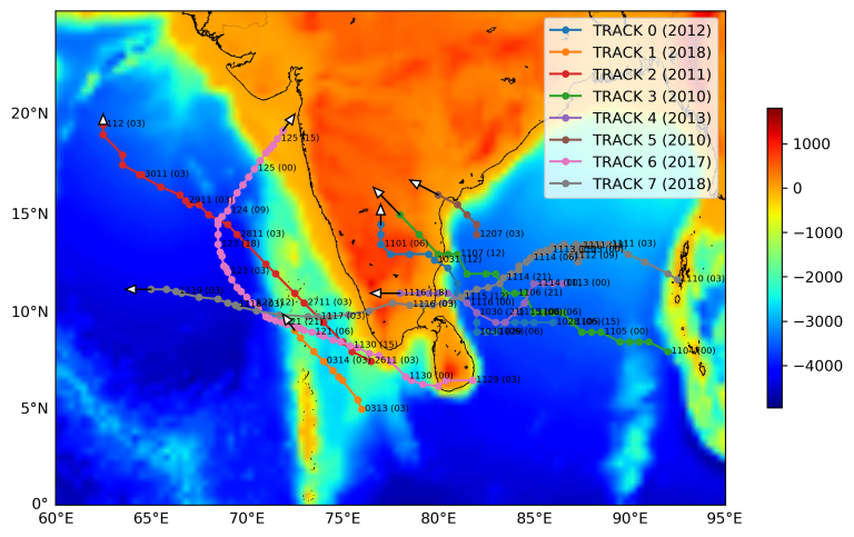
This article provides a step-by-step guide to plotting the trajectories of tropical cyclones on topographic maps using Python. It includes detailed code examples and explanations, enabling readers to visualize hurricane paths effectively.
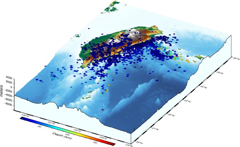
Read the earthquake data from a data file and overlay on a three-dimensional topographic map using PyGMT
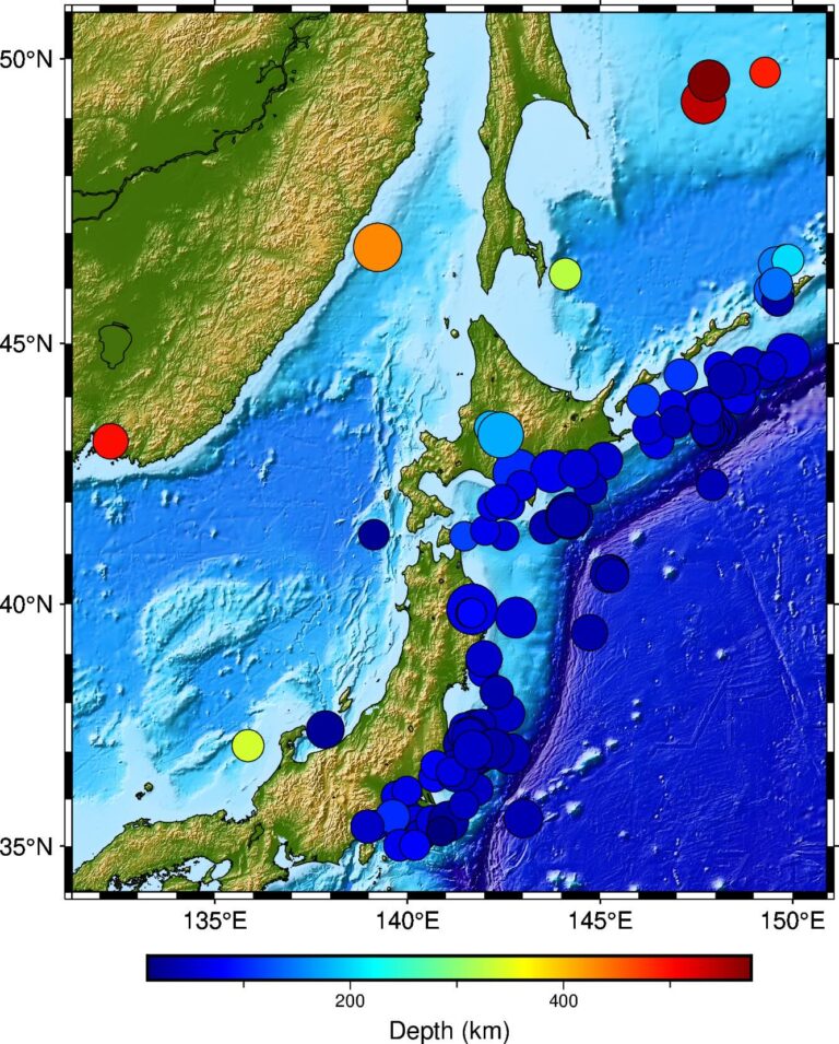
Read the earthquake data from a csv file and overlay on a topographic map using PyGMT.
A simple tutorial on how to plot high resolution topographic map using GMT tools in Python
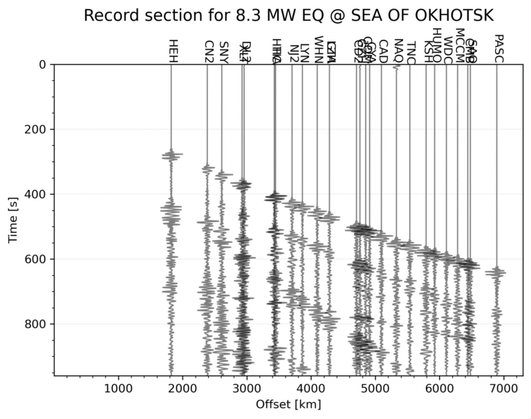
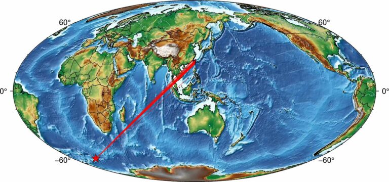
This tutorial demonstrates how to automatically generate a seismic record section for the largest earthquake within a specified time range and geographic area using Python. The process includes downloading seismic data, applying filters, and visualizing the waveforms for interpretation.
Learn how to create visually compelling relief maps in Python by clipping topographic data to specific geographic boundaries, such as coastlines. This tutorial walks you through the process of using matplotlib and Basemap to focus your visualizations on land features within the Taiwan coastline, or alternatively, highlight bathymetric features by masking the land.