Clipping Coastlines

Topographic map clipped by coastlines in Python

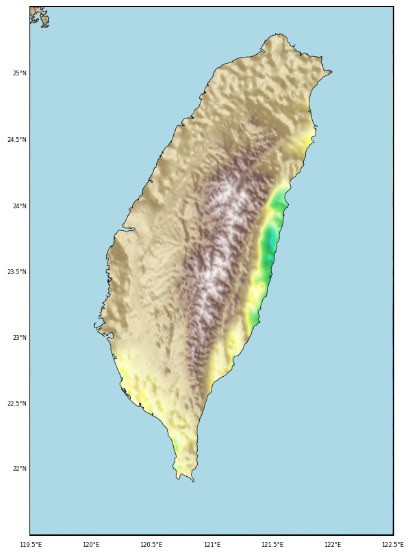
Learn how to create visually compelling relief maps in Python by clipping topographic data to specific geographic boundaries, such as coastlines. This tutorial walks you through the process of using matplotlib and Basemap to focus your visualizations on land features within the Taiwan coastline, or alternatively, highlight bathymetric features by masking the land.

Plotting the geospatial data clipped by coastlines in Python

In this post, we explore how to perform geospatial interpolation using the Ordinary Kriging method and visualize the results within the coastline borders of Taiwan. Learn how to efficiently handle irregularly distributed geospatial data and automate the process of clipping data outside geographic boundaries for more accurate and meaningful visualizations.