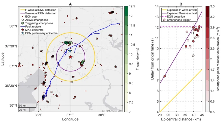
Review of “Smartphones Enabled Up to 58 Seconds Strong-Shaking Warning in the M7.8 Türkiye Earthquake”
Evaluating the Effectiveness and Challenges of the Earthquake Network App in Providing Life-Saving Alerts

Evaluating the Effectiveness and Challenges of the Earthquake Network App in Providing Life-Saving Alerts

Learn how to seamlessly sync your Zotero files across devices using WebDAV with Koofr and Google Drive. This step-by-step guide ensures your research materials are accessible on both your Mac and iPad, enhancing your productivity and workflow.

The field of seismology is undergoing a transformation, driven by breakthroughs in sensing technologies, machine learning, and high-performance computing. These innovations are enabling the detection of smaller seismic events, mapping hidden fault structures, and creating detailed 3D models of Earth's interior, opening new frontiers in understanding our planet's dynamics.

A study in Nature reveals that Earth's inner core, once thought to consistently super-rotate eastward, has slowed and even reversed direction. This challenges existing models, indicating a more complex interaction between the inner core, outer core, and mantle, with important implications for understanding Earth's deep interior dynamics.
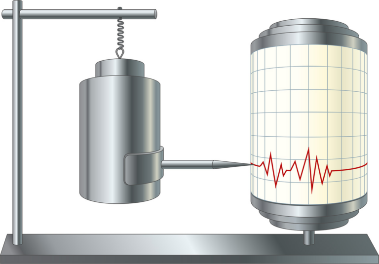
While MEMS accelerometers offer advantages in cost, size, and deployment flexibility compared to traditional broadband seismometers, they face limitations in recording long-period seismic waves. The future of seismic instrumentation likely lies in integrating MEMS and broadband technologies, combining the high spatial resolution of MEMS sensors with the sensitivity and bandwidth of broadband seismometers to enhance seismic monitoring capabilities across different scales and frequency ranges.

While MEMS accelerometers offer advantages in cost, size, and deployment flexibility compared to traditional broadband seismometers, they face limitations in recording long-period seismic waves. The future of seismic instrumentation likely lies in integrating MEMS and broadband technologies, combining the high spatial resolution of MEMS sensors with the sensitivity and bandwidth of broadband seismometers to enhance seismic monitoring capabilities across different scales and frequency ranges.

The advent of low-cost Microelectromechanical Systems (MEMS) sensors has revolutionized Structural Health Monitoring (SHM) of buildings, enabling cost-effective damage identification strategies. By leveraging wireless sensor networks and MEMS accelerometers, scalable and distributed systems for monitoring critical infrastructure are now possible. This article explores the integration of these technologies, including smartphone-based applications, to enhance infrastructure monitoring and maintenance.

Explore the power of mpi4py for simplifying data distribution in parallel computing with its efficient broadcast functionality, which seamlessly sends data from one process to all others, enabling synchronized operations across multiple processors.
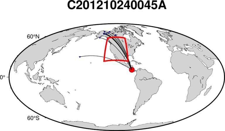
In this article, we will learn how to visualize the great circle paths that traverse a designated region of interest using PyGMT. Understanding these paths is crucial for rigorous seismic tomography investigations, as they can provide insights into the subsurface structure below the select region of interest.

Python script to read a PDF document, and perform question-answering on the document, and to generate an output based on the provided query